Sept 30, Vik
I have booked my car as of 11:00 today for seven days. But the guy preparing the car was keen to get me the car yesterday. He delivered it to me at 2:00 pm and then we did a drive about so he could tell me about Hofn and district. He showed me his farm with its horses and guest house that he is expanding. He is obviously the maintenance man for Avis/Budget and who knows what else.
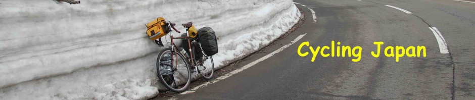
The point is, I had my car almost a day early. That way I had my bike loaded in the car yesterday and was away from the hostel this morning at 8:00. The day was partially sunny but the wind was wild.
My first stop was 65 km away at Jokulsarion, a lake at the foot of one of the massive glaciers that come down off of Vaatnakjokull. From Hofn, which is on a peninsula sticking out into the sea a bit, Vatnajokull fills the westward field of vision, fronted by the tallest mountains in Iceland and a number of exit glaciers that tumble down to sea level. The one that empties into the glacial lagoon, Jokulsarion, has created a tourist industry. The icebergs that calve from the glacier might float in the lagoon for years before finding their way out to the sea. A number of outfitters take tourists out among the icebergs to view the dramatic ice forms. On my visit no one was out; the wind was too bad. It was almost too bad to walk around; my walk was about 1/3 the time and length I would normally have been out there. At any rate, been there – done that.
My next stop was the Park Office for Skaftafell National Park. This is really the main Office for the whole of the Vatnajokull Wilderness area. The glacier covers 13% of Iceland, but the wilderness area is considerably larger. I would drive under the icefields all day, crossing over a huge river about every 10 km that often plunges over a dramatic waterfall on its way to the sea. The other aspect of this region east of the big glaciers are what is called Sandar. Flat plains of grey-black sand and gravel extend for most of the way along the face of the mountains holding back the icefields. These occur for about 200 km and are up to 40 km wide. The sandar are created from the runoff of these glacial rivers. In varying degrees the sandar are touched with lichen or other greenery, I imagine depending upon the time since the last flood.
Just before I got to the Skaftafell Park a cyclist on a recumbent who I had met after my first day’s riding in Borganes stepped out in the road as I was going by. At this point the wind was horrendous as it had been all morning. I noticed that he had waved down a large RV behind me. I stopped for a half an hour a bit later to take some photos and when I pulled into the Park there was his bike in front of the visitor centre. Somehow he had managed to talk the RV driver into taking him to the park, which sits in a bit of a wind shadow. I headed into the VC but he was gone when I came out.
I had a nice walk up to Svartifoss (Black Waterfall), which tumbles over black hexagonal basalt columns. I am worried that with the weather I will be unable to keep any of the fitness I gained cycling and so this walk with a pretty good climb, no wind and no rain was welcome.
Once on the highway I soon caught up to the recumbent rider who was making good headway. Unfortunately, within a few kms the rain and wind were back and I worry that he will have a tough final run in. I now wonder if he has been able to get others to ferry him through the bad sections. The way he stepped out to stop the RV driver indicates he had done it before.
There was not much more I could see or do on the way to Vik, as the rain settled in. There is a nice hostel in Vik that was quite filled with people. A lot of people who have been camping are now using hostels.
Oct 1, Selfoss
Very heavy rain. I had a hostel provided breakfast, and hung around a bit longer than usual. Finally I headed off in the rain. At Vik I was past Vatnajokull, but now I was passing under Myrdalsyokull and then Eyafjallajokull and so there was still lots of water coming down to the sea and falling over cliffs enroute.
My first stop was at one of the famous waterfalls, Skogafoss. There was no let-up in the rain and so photography was tough. It was fun trying to hold an umbrella while getting a slow motion type shot, which is sort of possible because of the low-light. Still it was nice to see, even in the rain.
A few kms down and off the ring road is Seljalandsfoss, made famous because there is a trail that takes you behind the falls. It was rainy enough for me, those walking behind the falls came out thoroughly soaked.
My next stop, still in the rain was in Hvolsvollur for a visit to their Saga Museum. This one is dedicated to Njals Saga, the longest and many consider the best of all of the Sagas. Njals is the first one I read, or I should say partially read. In the first part two strong women are responsible for having people killed. Finally one of them Hallgerdur, considered one of the real beauties at that time, is responsible for her husband Gunnar’s death when she refuses to let him braid a bow string from her hair. It is the third husband she is responsible for killing. In the second part the feuds continue until the hero Njal, one of the good guys is burned to death with his family and servants. The final part has Njal’s son chasing the culprit around Europe, but finally they resolve their differences. Interesting for me, in this tale, is the degree to which the Althing (Parliament) is drawn into these feuds. There are no jails but judgements may involve paying restitution and often involve exile. But mostly they just seem to exact their own revenge.
Oct 2, Laugrvatn
It was raining as I drove North. I headed onto what they call here the Golden Circle. My first stop along the way was at Gullfoss, possibly Iceland’s most famous waterfall. Gullfoss at one time was scheduled to be damned but activists in the 1920s put a stop to that. It rained most of the time I was walking about and so the falling mist from the falls didn’t contribute much to my discomfort.
The next stop was at Geysir, where there is a fairly large tourist service, with a big hotel, restaurants, mult-media centre and a great many things to purchase. There are steam fumaroles everywhere a few hot pools and on spouting geyser, not the original which has taken a break after many years of spouting frequently each day. The word geyser, an Icelandic word, has been passed on to the rest of the world from this original “Geysir”. The one spouting these days, about every 10 minutes, is called Stokkur. This thermal field sits right on the strip of activity that runs diagonally through Iceland and whenever something happens down in that inferno there is a possibility of change in the geyser action.
The multi-media show on Iceland’s volcanoes was very informative. There are something like 127 active volcanoes here and there is a fairly major eruption about once every five years. The last, Eyhaafallajokull, in 2010. The most devastating was Laki in 1783 which lasted for eight months and killed 8000 people and much of the animal life. A major migration of people resulted and there was discussion that perhaps the island should be deserted. Given that many of the volcanoes are under the glaciers the major issue that can happen is the dramatic mud and water slides that result when one of these goes off.
Oct 3, Laugarvatn
I am staying two nights at the hostel here as my visit today, Thingvellir, is not far away. Climbing away from Lake Laugarvatn I entered a plateau covered with a skiff of snow. It was still misty and so lovely in the soft light.
I imagined that I was one of the Godi coming from a far off place, a trip that had taken two weeks on horse and finally we were dropping down out of the mist to Thingvellir for the Althing that was held every year in June. There would be 47 other Godi and with our assistants and the bishops the Althing was officially 150 people. But with each Godi a representation of farmers from his district was also required to attend. And of course there were all sorts of others who came to provide support and food, to make representations on matters of law and claims against others. It was Iceland’s major happening and one of the first truly democratic forums. The Althing (parliament) at Thingvellir was entirely an outdoor venue. It began in 930 AD and lasted for three hundred years. Squabbles resulted in passing government over to Norway and then Denmark for the next 500 years.
Thingvellir is a world heritage site, and today it was breath-taking as I dropped down from above. The white snow highlighted the orange, yellow and red bushes in their fall colours that carpeted the hills. I walked the extensive grounds for a couple of hours drinking the history and the beauty. It is supposed to be past tourist season but the 1000 and some people I encountered must not have got the message.
Strikingly, Thingvellir sits on the crack separating the North American and Eurasian tectonic plates. A long cliff band seems to have had a 5 m slice cleaved off creating a gap about 10 m wide. A river runs along part of it and a wide tourist path fills in another part of it. Apparently the plates are moving apart some 2 cm a year, but here at the join it may make big slips every so often.
As I walked around I found the Logberg (Law Speakers Rock), where the Logsogumadur (Law Speaker) would recite his proclamations for all to hear. The Law Speaker, elected for a three year term, by the 48 Godar recited 1/3 of the laws each year and would act as the prime minister of the Althing. For 50 weeks of the year there was no government in effect. The Althing had no activities except during their two week meeting every year and that is when new laws were voiced and claims were adjudicated.
The yearly Althing is one of those events that would have been fascinating to go back in time to experience.

Thanks once again for great pictures and descriptions and history. Take care from Carol and family
Russell Sellick
>